(sometimes we provide two download links because it may happen that the main server / link is overloaded or slow or non responding - the files are identical. Just choose one, save to the Desktop, double click to install)
Disclaimer: to our best knowledge this download comes from a website that is
safe (the last time we checked it, it was), but for your peace of mind (and better safe than sorry) we advise you to run an
antivirus on the downloaded file. Do not rely on MSWindows, Internet explorer, or on the electronic signature: a unsigned download is usually as safe as a signed one, signed just means the author paid Microsoft or Verisign for a stamp, it does not mean verified. Please kindly
report us problems with detail (click here to report), if any.
OzGIS is an extensive system for the analysis and display of geographically referenced data. About 150 menus provide an enormous range of options The system can be used to analyze socio-economic and demographic data produced by censuses and surveys and to support management decisions associated with for example marketing, sales, site and personnel location, and advertising. Other spatial data such as environmental data can be displayed.
(
OzGIS is a system for the analysis and display of geographically referenced data)
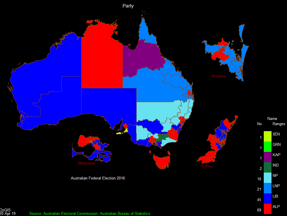
OzGIS is an extensive system for the analysis and display of geographically
referenced data. About 150 menus provide an enormous range of options for:
. importing data from databases, spreadsheets and Geographic Information
Systems (GISs) or downloaded from Census Bureaux or mapping agencies.
. processing data in preparation for display and analysis
. display of data as several different types of maps and diagrams.
. facilities to analyse displayed data and to manipulate the maps.
. Special support for site catchment analysis, location / allocation and
territory assignment.
The system can be used to analyze socio-economic and demographic data produced
by censuses and surveys and to support management decisions associated with for
example marketing, sales, site and personnel location, and advertising. Other
spatial data such as environmental data can be displayed.
Search for OzGIS on Youtube for tutorial / demonstration videos.
mapping software, census software, territory software

 Click here to start the download